Hidden Gems in Southern Alberta
Regardless of where you reside in Alberta, you can head in any direction and soon find several of Alberta’s jaw-dropping scenes. If you don’t want to spend a lot of money, other than the price of gas, there are numerous gems for you to discover and enjoy.
Glenbow Ranch
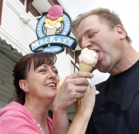
Just a short distance from Calgary head west on the 1A Highway and visit the Glenbow Ranch Provincial Park. It is a working ranch that has several paved trails which ideal for biking and hiking. The park offers spectacular views of the Rocky Mountains and the Bow River. Top the day off with a cool ice cream cone from the world renown MacKay’s Ice Cream in Cochrane, just minutes away from the park.
Bragg Creek
Another location just a short distance west of Calgary is Bragg Creek, located in the heart of the foothills. It is ideal for exploring and hiking. Just west of the hamlet is where the confluence of the Elbow River and the Bow River meet. Check out Elbow Falls Provincial Recreation Area, Forget Me Not Pond, or Mclean Creek Recreation Area. They are ideal locations for enjoying a family picnic and hiking.
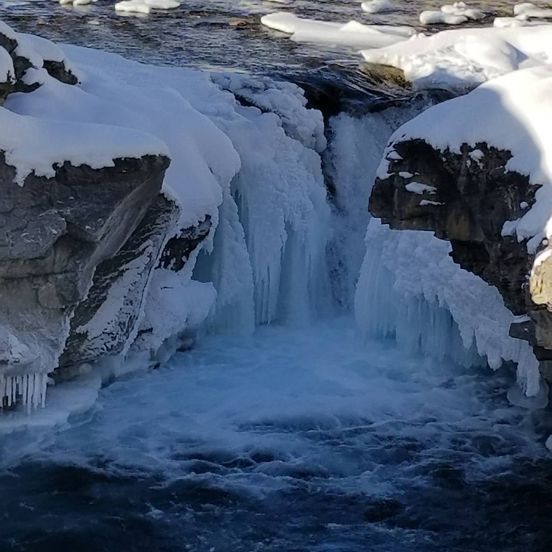
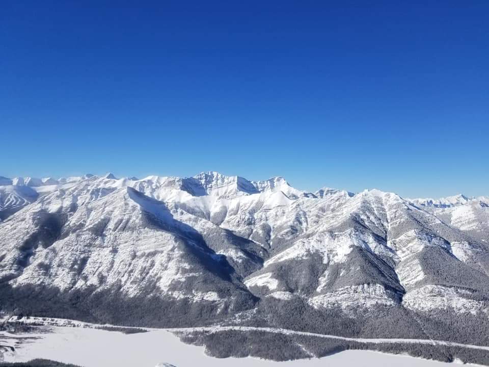
If you are planning a longer trek continue west into the foothills and the Rocky Mountains and you will be rewarded with some spectacular views of the jagged sentinels and the turquoise blue lakes that are prevalent throughout the mountains. There is a good opportunity to view some of the wildlife such as bears, elk, mountain sheep, goats and deer. Although, if you do stop to take pictures, be very careful not to get too close to the animals.
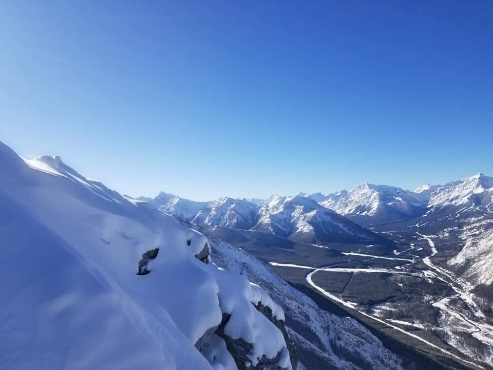
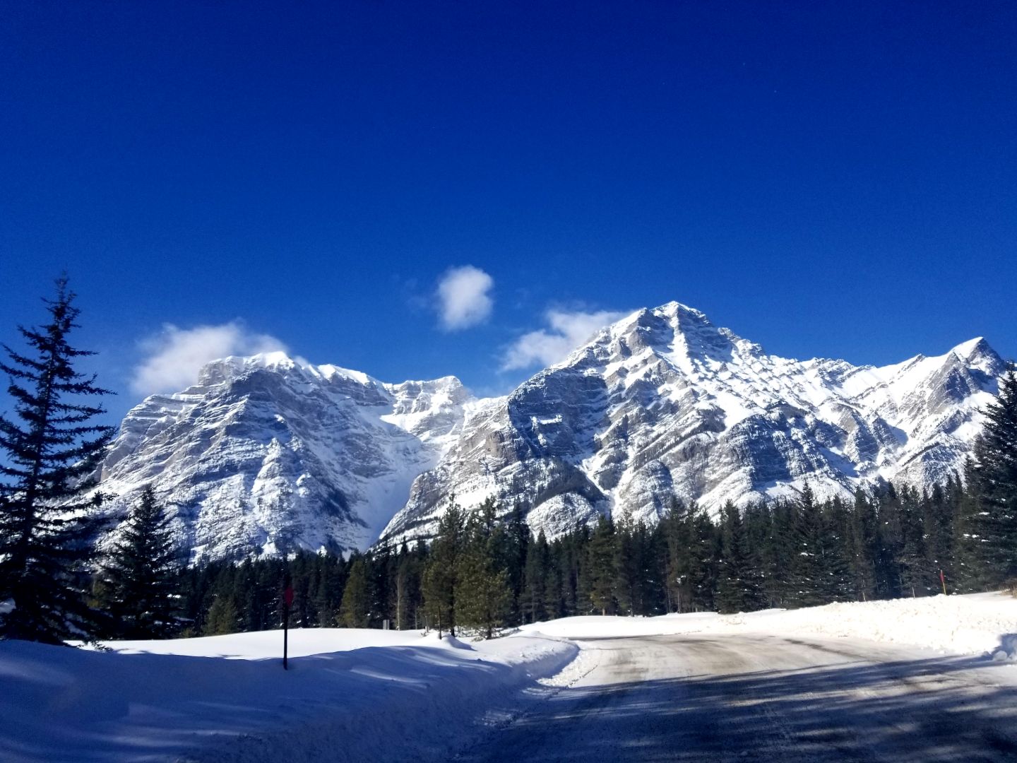
Kananaskis
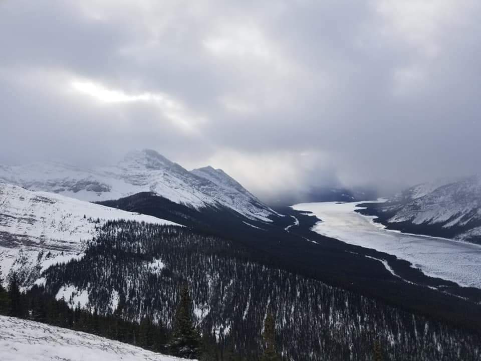
Kananaskis country has numerous trails to hike or places to sit beside a waterfall and enjoy a picnic. Head down Highway 40 that runs through the heart of Kananaskis. The highway is closed to vehicles south of Kananaskis Lakes from December 1 to June 15 each year. However, it is a favourite cycling route in May and during the first half of June, when the road is free of snow. Cyclists have the road to themselves during that period. If you can make it to the Highwood Pass, it is worth the work-out, because the view is spectacular. It is a 12.5 kilometers cycle from Upper Kananaskis Lake to the Pass, and it is mainly uphill getting there. The Highwood Pass is the highest paved highway in Canada (2206 m, or 7238 ft).
If cycling isn’t your thing, motor down the highway when it is open. Make it a day trip and exit the highway near Longview. From Longview cruise up Highway 22 and enjoy the small-town ambience of Black Diamond and Turner Valley, and then head east back to Calgary. The drive is about 300 kilometers total in a roundabout route that leads you north back to Calgary.
Cruise Cowboy Trail
If you don’t want to go into the mountains, but would rather view them from afar, drive along the Cowboy Trail. The Cowboy Trail, which is Highway 22 located west of Calgary, is 735 kilometers of paved blacktop that stretches from Cardston in the south to Mayerthorpe in the north. The southern drive offers amazing views of the foothills and the mountains and runs through little communities such as Turner Valley, Black Diamond, Longview, and Lundbreck.
Cardston
If you drive south to Cardston, make sure to check out the Reynolds Carriage Museum. 54 kilometers west of Cardston is the beautiful Waterton Lakes National Park which possesses much of Alberta’s natural wonders. The park offers numerous hiking trails and it is especially beautiful in late May and early June when all the wildflowers are in full bloom. The park commemorates the numerous plant species (over 1000) that are found in the park with The Wildflower Festival in June.
South on Highway 2
Another southern route to explore is Highway 2 south of Calgary which leads you through quaint little communities like Okotoks, Nanton, Claresholm and Fort McLeod. Nanton has several museums to peruse. The Bomber Command Museum of Canada is a must-see as well as the Canadian Grain Elevator Discovery Centre and the Museum of Miniatures. There is a fee for entrance to these museums.
A popular stop for tourists is the World Heritage Site Head-Smashed-In Buffalo Jump, just west of Highway 2. It is one of the world’s best-preserved buffalo jumps, and it has an interpretive centre. One can imagine the sound of thundering hooves as large herds of buffalo pound across the wind-swept prairies unsuspecting of their fate that awaited them. The view offers a spectacular vista of the prairies and the rolling foothills.
Highway 2 south ends at Fort MacLeod. There, drivers can go either east towards Lethbridge or west towards Pincher Creek and the Crowsnest Pass. The Crowsnest Pass cuts right through the mountains into British Columbia. You may want to stop in at the Frank Slide Interpretive Centre and view and learn about the mountain that tumbled down on the town of Frank in 1903. It is a solemn spectacle.
Prehistoric Sites
If you are looking to be transformed into another time when dinosaurs roamed the earth, then there are several areas in southern Alberta to view them. Writing on Stone Provincial Park near Milk River in the deep south of Alberta will take you there. Wind-swept hoodoos provide a landscape that is prehistoric. There is camping and hiking in the park as well as guided tours of pictographs and petroglyphs. Beware, there are rattlesnakes in the area.
More of the same prehistoric landscape can be viewed at Dinosaur Provincial Park near Brooks. Camping is available but if you choose to do so you will need to reserve a site. The most notable prehistoric looking landscape is in the Drumheller area, east of Calgary. Before you enter the town be sure to stop at Horsethief Canyon, which offers a stunning view of the valley below. It is worth stopping for a picture or two.
The town of Drumheller is all about dinosaurs, and in fact it has the tallest dinosaur in the world. The World’s Largest Dinosaur, a model of Tyrannosaurus Rex, has a viewing area in the dinosaur’s mouth. There is a price to enjoy that view. Many of Drumheller’s stores and parks feature dinosaur sculptures for public viewing. Just west of town is the world-famous Royal Tyrrell Museum. If you are planning to visit the museum, please check for times it is open and the cost of entrance. Be sure to stop by the Little Church which is on the way.
Instead of going west from Drumheller go east and stop at the Hoodoo Trail. A short hike through the mushroom-shaped hoodoos takes one back to another era a long time ago.
In the deep south east of Alberta, Cypress Hills looms above the bald prairie. It is like an oasis containing a diverse mix of forest, wetlands, grasslands, animals and birds. There is camping and a visitor’s centre, and lots of hiking trails. Some of the views will literally take your breath away.
South-East Alberta
If you make the trek to deep south-eastern Alberta, stop by the Medalta Museum in Medicine Hat where the company used to make clay pots and vases. Their kilns look like giant beehives growing out of the ground.
Red Rock Coulee, a natural area that some people regard as what Mars may look like, is approximately 50 kilometers south of Medicine Hat. Huge red boulders dot the landscape and it is a must-see experience. There aren’t any amenities in the coulee, but it is definitely worth drive if you are in the area.
Alberta has numerous towns and areas to explore, and boundless natural beauty, regardless of which way you head out on the road. Most towns have festivals, fairs and rodeos throughout the summer months and the information is just a click away on a computer or smart phone. It is ours to explore. Get out and enjoy it.
Alberta: the history and more
Alberta, the most westerly of Canada’s three Prairie Provinces, joined the Confederation of Canada and became a province on September 1, 1905; the same day that Saskatchewan joined the Confederation. Before then Alberta and Saskatchewan were considered part of the Northwest Territories.
Alberta was named after Princess Louise Caroline Alberta, the fourth daughter of Queen Victoria. At the time, Queen Victoria was the sovereign head of state for the British Empire.
Origins
Alberta was inhabited by First Nations’ indigenous peoples for 10,000 years before it was discovered by European explorers in the 1700’s. Europeans such as Peter Fidler, David Thomson and Alexander MacKenzie, were the first to establish European settlements and map the vast area. Alberta is the fourth largest province in area in Canada. The first European settlements in the province were Fort Chippewan and Fort Vermillion, established in 1788.
Alberta is also the fourth largest populous province in Canada with over 4.2 million people. While Calgary is the largest city in the province, Edmonton, the second largest city, is Alberta’s capital. The first premier of Alberta was Alexander C. Rutherford, who served from 1905-1910. Rachel Notley is the province’s current premier, elected in 2015.
Landscape
The province’s landscape is rich and diverse. There are Badlands near Drumheller in the east and Milk River in the south, and the prairie stretch north and west between them eventually giving way to the foothills that roll into the spire peaks of the Rocky Mountains.
Alberta is part of the Prairie Provinces, along with Saskatchewan and Manitoba. It is known for its big open spaces and big skies, providing beautiful sunsets. The ranches and farms reflect the open spaces as many of them are sprawling, huge spreads used for raising cattle and growing grains. The land is rich and fertile, if irrigated, where fields of wheat, canola, barley and oats thrive. Wheat is the largest agricultural export from the province, followed by canola, live cattle and Durum wheat. The main destination for these exports is the United States, Canada’s largest trading partner.
Industry
Oil
The main industry in Alberta is oil. Alberta’s oil is the third largest export commodity in the world, behind Venezuela and Saudi Arabia, and the province houses the third largest oil reserves in the world. Alberta is also the second largest exporter of natural gas in the world and is the world’s fourth largest producer of natural gas.
Much of Alberta’s crude oil is found in the Tar Sands in northern Alberta, although the first major crude oil discovery was found in Turner Valley, south of Calgary, in 1936.
Tourism
Tourism is another major industry in Alberta as visitors spent over $8 billion in the province in 2016. Over 35 million tourists visit the province annually and it is easy to understand why so many people visit the province, with its pristine lakes and mountains which provide cross-country and downhill skiing and fishing, as well as hiking and mountain climbing.
The Bow River is internationally renown for trout fishing. Other popular tourist destinations besides the Calgary Stampede and the other major cities include Banff, Jasper, Lake Louise and Waterton Park. If you are searching for less popular destinations check out Dry Island Buffalo Jump Provincial Park or Head-Smashed-In Buffalo Jump, a World Heritage Site. You may also want to visit Dinosaur Provincial Park near Brooks, or Drumheller and Milk River. It is like taking a trip back through time with their diverse landscapes that contain mushroom-shaped hoodoos, eroded by the wind and the weather over thousands of years. The Royal Tyrrell Museum near Drumheller has the largest collection of dinosaur bones and fossils in the world, and Drumheller has the tallest standing dinosaur in the world. It is worth a trip just to see it.
People
Some notable Albertans include:
- Tommy Chong (actor);
- Tricia Heifer (model/actress);
- Joni Mitchell (singers/songwriter);
- K.D. Lang (singers/songwriter); and
- Feist (singers/songwriter), to name a few.